Showing posts with label camper trailer. Show all posts

Monday, November 7, 2011

A Dream come True

Some of the places we camp are very cool, but every now and then we discover somewhere exceptional. After we left Karijini, we headed for the Exmouth Peninsula and Cape Range National park. The park has a limited number of camping spots, so if it is full, you have to wait for someone to leave, before the next camper can enter. We had heard stories of people waiting at the entrance gate from 4:30am, just trying to get into the campsites. We arrived at 5:30pm and the ranger was nowhere in sight, so we just drove straight in and began looking for somewhere to set up. We settled on Osprey Bay, about 36km south of the entry gates, where there were three empty places.

Osprey Bay was one of the best campsites available, a fact we confirmed as we explored the area for the next 6 days. Our campsite host was happy for us to set up and sort out the details the next day, as the light was fading fast, and it takes a while to get everything ready.

PB042391

Early the next morning, we wandered down to the beach entrance and snorkelled out to see if there was anything interesting underwater. About 30m offshore we discovered a large, deep hole in the rocks that was home to several hundred fish, of all colours, sizes and shapes.

PB052395PB062491PB062496

Unfortunately, it had been a while since a grocery shop had been available, so we had to run into Exmouth and pick up some much needed supplies, fuel, water, all the usual suspects. Further exploring would have to wait until the next day.

As became our custom, we started the next day snorkelling. This time we headed for Turquoise Bay, a renowned reef destination, where you walk to the south end of the beach and enter the water, and the current pulls you along the reef until you reach the sandy point where you walk back up the beach and do it all again. And again. And again. It was amazing. As soon as you put your mask on, you were surrounded by a large school of curious Dart fish schooling on the sand. A short swim to the reef and the underwater environment literally exploded into life all around.

PB062495PB062492PB062505

Ningaloo Reef is Western Australia’s Great Barrier Reef. It runs south for 300km from the tip of Exmouth Gulf and is accessible from the shoreline in many places. Snorkelling on the outer reef is not recommended, due to the Indian Ocean crashing huge breakers constantly from the continental shelf, which is at its closest point to the Australian mainland. Not very far from the shore, the ocean plunges over 1600m deep. But snorkelling from the beach is easy enough, and there are many choices, depending on your skill level and fitness.

A short walk around the point at Turquoise Bay brought us to a calmer, more protected beach, where the snorkelling was easier, but less rewarding. There were still plenty of fish around, but the reef lacked the colour and variety found in the faster flowing waters. Josie and I decided to complete one last trip around the reef, and on the way back to shore, we managed to spot a Green Turtle lying on the bottom watching us. He swam away slowly, so we followed him for a little while, before leaving him alone. Amazing! Never in my lifetime would I have ever considered that we might swim with turtles, and Josie is only 12.

PB072559PB052437PB052455

Once we finished snorkelling, we began our daily pilgrimage to the closest water tap to fill our 20 litre shower bottle. A flock of Emu’s knew where to find water, so we arrived to find several large birds guarding 6 smaller chicks and the only water tap for 50km. Luckily, Daniel was willing to brave the large birds to fill the water bottles, so we could all have warm showers each night.

PB052407PB052410PB052424

We returned to Turquoise Bay several times over the next few days, but a fellow camper told us we should check out a site called The Oyster Stacks. Due to Rosa’s recent unfortunate accident on the Oysters at 80 mile beach, we were reluctant to visit, but we were assured it was worth the risk. The other important detail is to enter the water at high tide, as the reef here is very shallow. We found out that tomorrow mornings high tide was at 8:20am.

We left on time for our snorkelling adventure, but Rosa was apprehensive, and Leisl flat out refused to enter the water. She read a book on the shore. We put Rosa on her inflatable boogie board, to keep her above the water, and fitted our own masks, snorkels and fins. As soon as I put my face in the water, I was transported into an enormous fish tank! It was like the set of ‘Finding Nemo’, and we hadn’t moved off shore yet. Once we all got going, we discovered that this was the BEST snorkelling on the coastline. (AND it was our last morning!!! Doh…). Huge fish were hiding under the rocks in their dozens, the reef was alive, colourful and vibrant, we saw a starfish that would have measured 50cm across, and much, much more. It was incredible. There were no incidents with the oysters, as we were all very careful. As we left the water, we decided we should go back to Turquoise Bay for one last float along the drift.

PB072549PB072553PB072544

We also took a few walks along the beach, spotting turtles, or wetting a fishing line in a vain attempt to catch a fish, or watching the kids play at the waters edge. I also am learning more about our digital SLR camera, so have been experimenting with sunset shots. I still take way too many photos to get a good one, but every now and then, they come out all right.

PB062521PB072561PB072595PB062513


At the moment the beach and water are constantly filled with Green and Loggerhead turtles in the midst of their breeding, egg laying and hatchling cycle. There is plenty of evidence of these activities, and Karen took great delight in telling the children that they were Humpback Turtles. Until she overheard Rosa telling another child, who had just arrived at the campsite, “Oh those are Humpback Turtles! in the water” Try getting an explanation for that one from his parents…

Early on the last day, no-one wanted to get out of bed. No-one wanted to eat breakfast. No-one wanted to face the inevitable. It was time to leave. It was like pulling teeth, trying to get the kids to pack up clothes, beds and rubbish. Finally, we managed to pack up and head off to our next, as yet unknown, destination.

Wherever we are headed, it’s going to be very difficult to beat Ningaloo Reef.

Thursday, November 3, 2011

Karijini National Park

One of the new Bridgestone tyres we just purchased in Darwin blew up about 150km from Port Hedland. Replacing a wheel on the side of the road is rarely fun, but it’s really warming up so now everything is hot as well. Once the job was done, we had to delay one night in Port Hedland to replace the tyre, as we are unwilling to drive too far with only one spare. And it was Sunday!

PA302063

Seeing an opportunity to make the most of it, we did a little exploring around the busiest port in the Kimberley. We watched the huge ships docking and departing the harbour in rapid fire succession. We viewed the BHP documentary on their Iron Ore operations in the Visitor Information Centre. We even managed to package up and send our 80 mile beach shells away. A job offer was turned down within five minutes of arriving, as we want to keep moving. So we booked into a caravan park for the evening, and waited for the tyre store to open.

3010201111930102011120

The next day we headed directly south to Karijini National Park. This park is all about the gorges, of which there are several to explore. The campsite is located near Dales Gorge at the eastern end of the park. We set up camp and settled in for the evening.

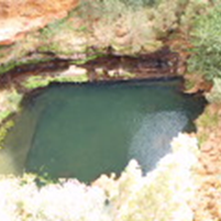
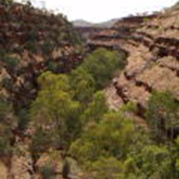
The next morning we tottered off to investigate and explore Dales Gorge. It’s home to three well known sites, Circular Pool, Fortescue Falls and Fern Pool, at either end of a beautiful creek walk. No-one was feeling particularly energetic, so we elected to view Circular Pool from the lookout above and walk down to Fortescue Falls. At the top of the waterfall is another track (unmarked) leading off into the bush, which eventually lead us to Fern Pool. It is a simply stunning environment, with twin waterfalls dropping delicately into the crystal clear pool below. Various types of ferns line the rock walls either side of the falls, and there are some very interesting rock formations near the boardwalk.

Back at the top, and we are exhausted and decide its time to hit the campsite and prepare lunch, contemplating another exploration in the afternoon. By the time lunch is finished, we can hear the distinct sounds of several thunder storms surrounding us. We decided to wait a while and see what direction they may head. Good decision. That afternoon, and most of the night, it simply bucketed down. At one stage the wind was so strong that it lifted several poles from our awning and dropped them to the ground. Daniel and Karen hurriedly went to resurrect the fallen tent, and in doing so encountered the hail stones that had accompanied the storm. Finally the tempest abated and we were able to relax a little, and get some sleep.

PB012199PB012202PB012196

The next morning still looked overcast, but the clouds were reasonably high, and it was decided that we should head for the Weano Gorge area and see what was on offer. It is a 50+km drive from the campsite, so we took our lunch along for the drive. Stopping briefly at the Visitor Information Centre to learn more about the area and its native people was interesting, but our curiosity was for the gorges themselves, so we set off to the northwest.

Right at the end of the road was the Oxer Lookout, which overlooks Red Gorge. What is amazing from this viewpoint, is that three smaller gorges all merge into Red Gorge in the colourful vista before you. Weano Gorge comes from behind to the left. Joffre Gorge is right in front, and Hancock Gorge disappears around a corner to the right. All three creeks meet at Junction Pool and merge to form Red Gorge. It is spectacular. We met the ranger here, and he warned us “If it starts raining, you get out – straight away.”

Walking into Hancock Gorge first, at the rangers recommendation, had us a little on edge. We knew we could walk as far as Kermit Pool, but beyond that required the use of abseiling and rock climbing equipment. As we descended into the system, we climbed down the last ladder to creek level and followed it downstream. As predicted, the further we went, the smaller the gorge became, until it was less than 1 metre wide. The rangers warning came to mind – a small rainfall upstream would create a flash flood with disastrous results downstream. We walked to Kermits Pool, took three photos and left. Quickly.

After devouring a lunch, we wandered over to Weano Gorge, with its descent to Handrail Pool. With the clouds looming overhead, and the sound of distant thunder, it was too much for Leisl and Rosa. Karen accompanied them back to a safe spot, while Daniel, Connor and Josie continued the trek. We followed the creek along again, and came to a large pool cut into the surrounding rocks, where a handrail had been fixed to the wall to make the final descent easier. Again its rock climbing and abseiling from here, so we returned to the relieved girls as quick as we could.

On the way back to camp we stopped for a brief look at Joffre Falls, Knox lookout and Kalamina Falls. After the adrenalin rush of the first adventure of the day, they all seemed a little tame. Desperately in need of a hot shower, we finally headed to camp for the evening.

PB022338PB022383PB032384PB022331PB022377

Our final day dawned clear and sunny, the perfect day for walking around in treacherous gorges. Never mind, it has been an adventure none-the-less.

Sunday, September 18, 2011

Gibb River Road – Part 4 – The Other End

When we left Bell Gorge, it was a great relief to get off another really bumpy road, and back onto the (relatively speaking) better quality of the Gibb River Road. The drive to Windjana Gorge was not far now, but we stopped for lunch at a rest stop beside the Lennard River. We had passed Lennard Gorge, Adcock Gorge and Galvins Gorge along the way, but didn’t find out till later, that they were easy to get into and quite picturesque. Oh well, we have to leave some reason to return to this area at another time…

The drive to Windjana Gorge and campsite was uneventful, although we are getting a bit over dirt roads after 10 days of constant shaking. We set up camp and lazed around for the afternoon, knowing that our friends, John and Lyn would pull into camp sometime.

pano

Early the next morning we completed the walk through Windjana Gorge. This area is significantly different from every other gorge along the GRR. To start with, the gorge follows the Lennard River through a series of limestone cliffs, rather than the sandstone we have become accustomed to. At the end of the walking track, it just stops. It doesn’t reach a pinnacle, or enclosed rocky gorge, but instead just stops suddenly. AS we walked along the track, we were rewarded with many freshwater crocodile sightings. We saw 26 crocs on the walk into the gorge, and 32 on the way out. We also saw a fruit bat colony among the paperbarks, and many archer fish in the water espying their insect prey above the surface and shooting them with jets of water. They are amazingly accurate and can fire this water jet up to 2 metres.

The limestone cliff walls display the characteristic signs of stalactites and stalagmites growing on their surfaces. This is the sort of thing you can usually only find inside limestone caves, so it was most unusual to observe it on the cliff walls. The limestone also houses many fossilised animals and insects, and one part of the walk reveals these treasures up close. The kids had a great time looking for fossils among the rocky cliff surfaces, and managed to find a few.

P9180759P9180767P9180768P9180771P9180775


P9180772

Note: There are 5 freshwater crocs in this photo alone!

After lunch back at the tent, we set off to look around Tunnel Creek, having heard from many travellers that this is a MUST-SEE destination. It is 35km south of the Windjana Gorge campsite, and the only facility is a toilet near the entrance. We had some expectations, based on the things we had already heard, but found ourselves quite unprepared for how amazing this site really is.

We climbed down through the rocks towards the entrance and we greeted with a wide open chasm with a large swimming hole and a rocky track off to the right hand side. We followed the sounds of other walkers along the track, until we came across our first opportunity to cross the creek. We were warned that this would happen, but that did not diminish the ominous feeling standing there on the small sandy beach, looking into the dark water of unknown depth, with torches that suddenly felt too dim and contemplating which way to go. Fortunately, a couple came back the other way, showing us where to step and how deep the water was. We quickly became accustomed to the cool water temperature as we found our way along the dark tunnel, crossing the creek several times, and arrived at the mid-point where the roof has collapsed.

P9180859P9180783P9180788

The sudden burst of sunlight into the cave provides a view of the fruit bat colony living on the stalactites hanging precariously from the cavernous ceiling. Continuing our journey, the creek became deeper (about one metre), so our nether regions got a taste of the cool water also, testified to by the shrieks emanating from the suddenly frozen children. This was the deepest water crossing and the end of the tunnel was in sight ahead of us. We were approaching midday, and had almost reached the end, when a beam of sunlight shot down from an opening in the roof. Awesome! It felt like this little sojourn had been blessed by God himself.

P9180804P9180810P9180813

Once we exited the cave, we turned left as advised and discovered some aboriginal rock art high on the cliff faces to the side. The major discussion at this point was “How did they they paint that, way up there?” theories abounded, but Connors offering was the best - “They floated past on canoes in the wet season, painting as they went.”

P9180795P9180789

Our next decision was to either follow the walking track through the surrounding bush, or walk back through the cave again. There was no votes for the walking track. Tunnel Creek is definitely a MUST SEE destination.

P9180818

We returned to camp for lunch, and were lazing around afterwards, when John and Lyn arrived. It is always fantastic travelling with friends, and we have thoroughly enjoyed having this remarkable couple around for quite a while now. We have managed to take them a few places they might not have seen otherwise, and today was to be another adventure for them. Off to Tunnel Creek we went for the second time….

We have taken 10 days to cross the Gibb River Road, including Mitchell Plateau, but we could easily spend more time completing the journey. There is so much more we could have done, but we have left it for NEXT time! Timing is an essential part of planning this journey, and we arrived at the end of the tourist season, when there were fewer people around and less water in the river crossings. Earlier in the year, it would have been a completely different trip, and probably a lot more stressful.

I hope you have enjoyed reading the 4 instalments of this journey. As we continue our trip, there will be plenty more to whet your travelling appetite…..